
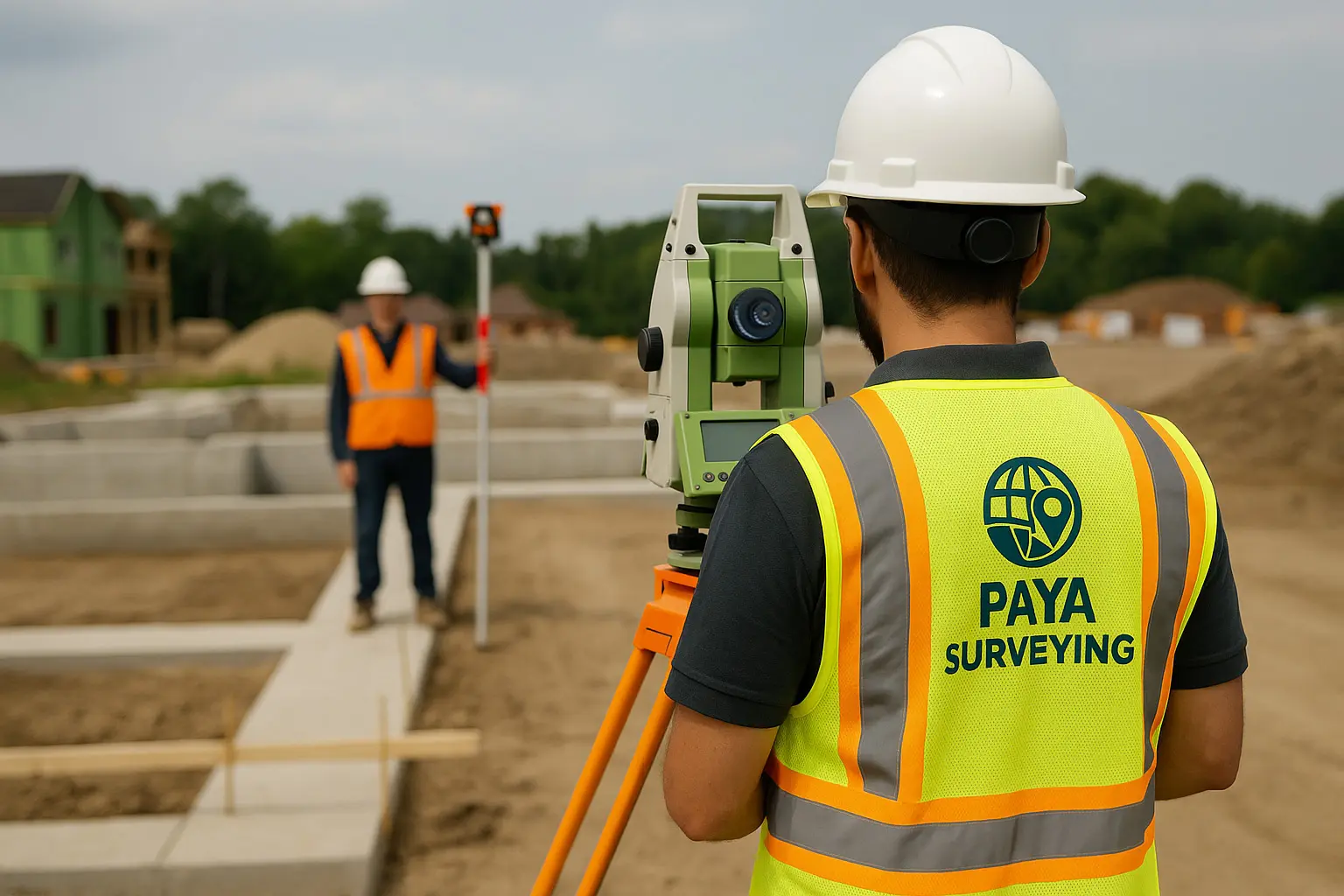
Grading & Site Plan Services in Toronto & GTA
If you’re searching for grading site plan Toronto, you likely need one thing: a clear, permit-ready drawing set that explains drainage, elevations, and site layout without confusion. Paya Surveying supports homeowners, designers, and builders with grading and site plan drawings that reduce revisions and help approvals move faster.
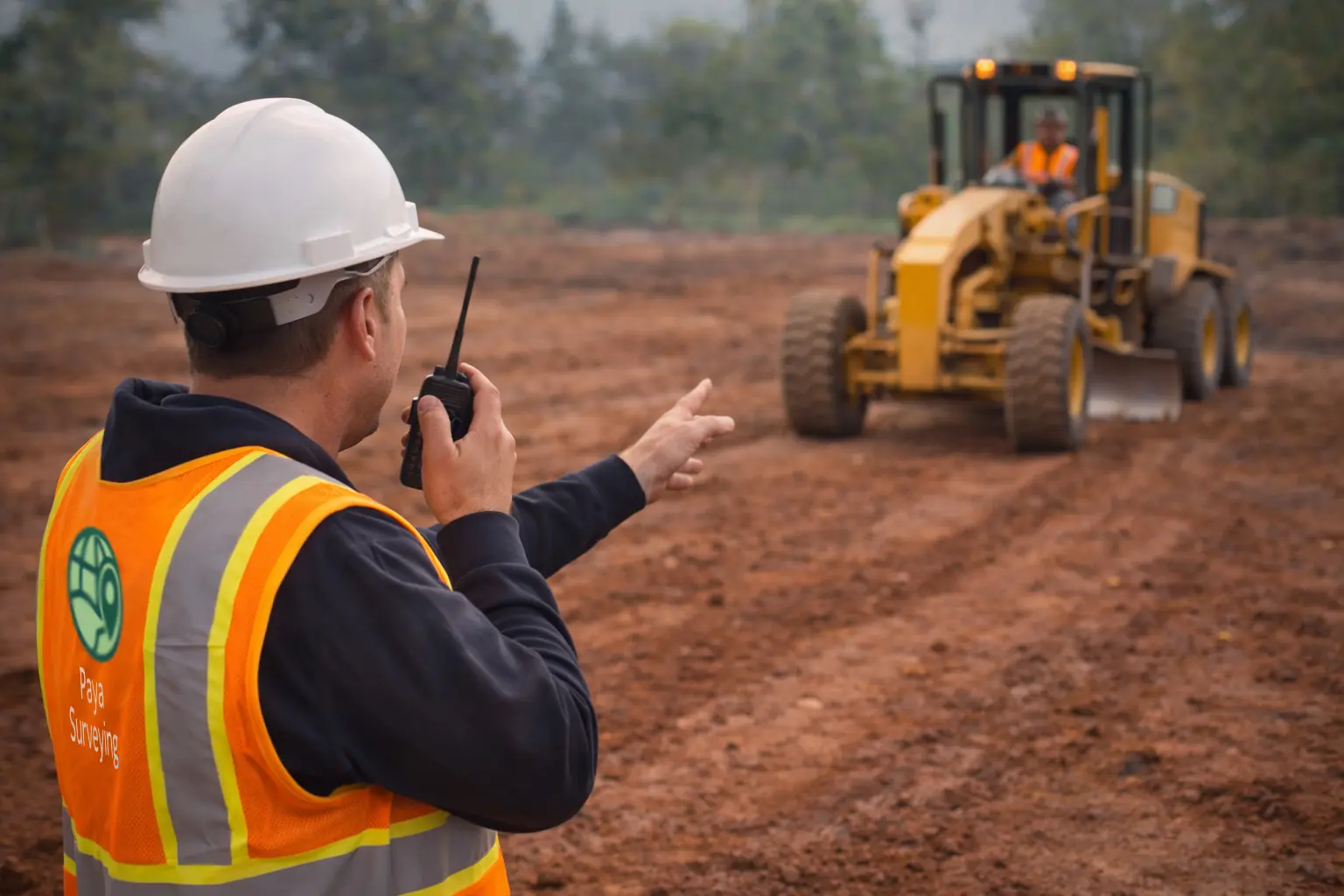
Common prerequisites include property surveys and topographic surveys. For staking later, explore construction layout.
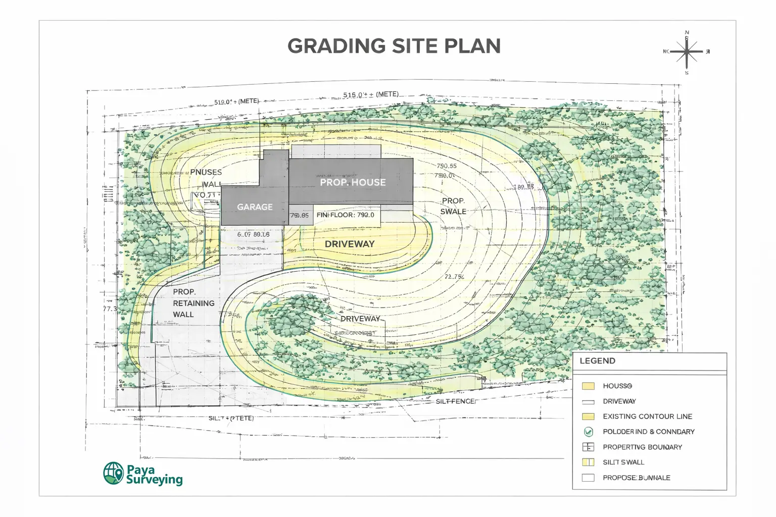
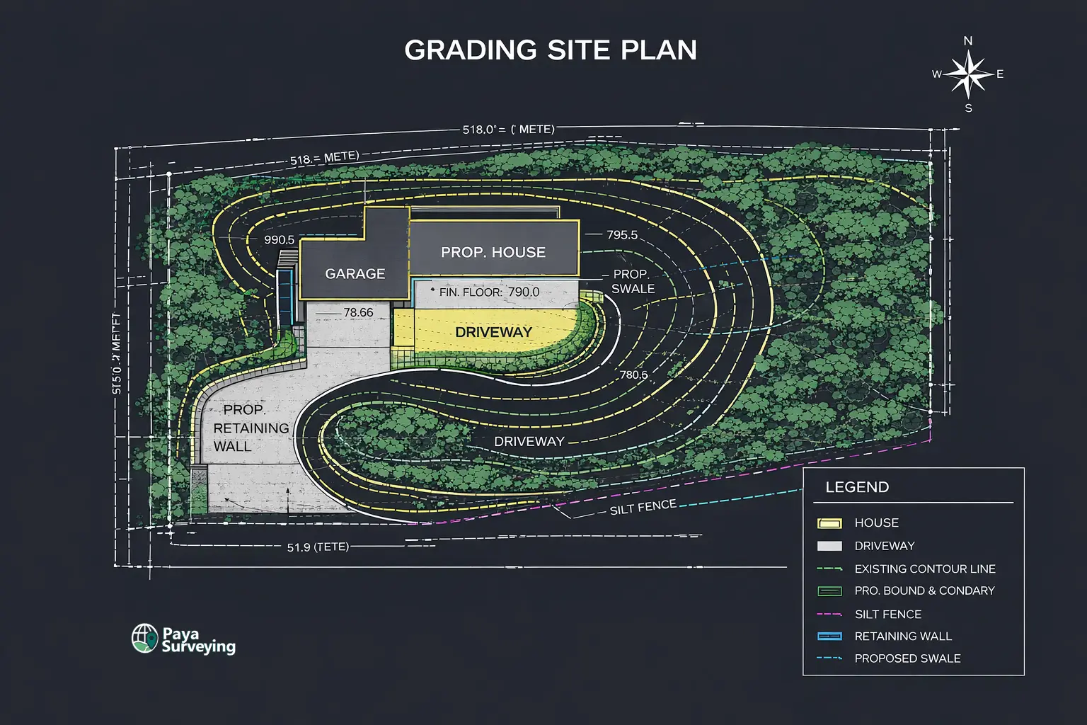
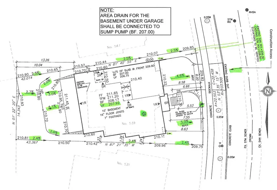
- Existing & proposed grades (spot elevations)
- Drainage direction and surface flow clarity
- Site layout (structures, setbacks context, key dims)
- Clean PDF deliverables; CAD-ready outputs optional
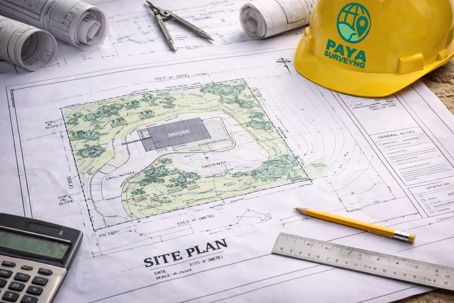
What Is a Grading Site Plan in Toronto?
A grading site plan explains how your property will drain using a structured drawing set—existing conditions, proposed grades, and key elevations—so reviewers and builders can make decisions confidently.
Why “grading site plan Toronto” matters for approvals
Many permit delays happen when drawings don’t clearly communicate drainage intent. A strong grading site plan helps reviewers understand how water will flow, where grades transition, and how your design ties into the surrounding conditions.
When the base survey is accurate, the grading plan becomes a reliable reference for designers and builders. It reduces conflicting assumptions, makes revisions easier, and supports cleaner permit packages.
When Do You Need Grading & Site Plan Services?
Not every project needs the same drawing set. These are common Toronto and GTA scenarios where a grading site plan helps avoid rework and supports approvals.
Additions, rear extensions, new entrances
Expanding footprint or changing hardscape can redirect drainage. A grading plan clarifies proposed grades and helps coordinate the site layout with design intent.

New builds and infill housing
New houses typically require clear grading intent and elevation control. A complete base plan helps the design team keep drainage and finish grades consistent from review to construction.
Drainage concerns, slope changes, regrading
If your site has slope transitions, retaining conditions, or drainage issues, a grading plan documents how grades are managed and where water is directed.
Permit packages needing site drawings
Reviewers often need site layout context and elevation information for a complete application. A grading site plan improves clarity and reduces back-and-forth.
What You Receive
Our grading and site plan deliverables are built for real workflows: design coordination, permit submission, and construction clarity.
Grading plan clarity (existing & proposed)
We show the grading intent using spot elevations, slope indicators (where applicable), and clear notes so the drawing is easy to interpret—especially when multiple trades are involved.
Drainage direction and elevation control
Drainage arrows and elevation callouts help reduce misunderstandings. The goal is simple: make it obvious how water will move across the site once construction is complete.
Site layout context
A site plan supports the permit story: what exists, what is proposed, and how key site elements relate to the design. This is strongest when the base survey data is accurate and current.
Our Workflow for Grading & Site Plan Services
A consistent workflow helps keep drawings consistent. Here’s how we typically deliver a grading site plan for Toronto & GTA projects.
1) Scope check (fast)
You send the address, timeline, and project goal. We confirm which drawing set you actually need: grading-only, site plan + grading, or a full package with topo support.
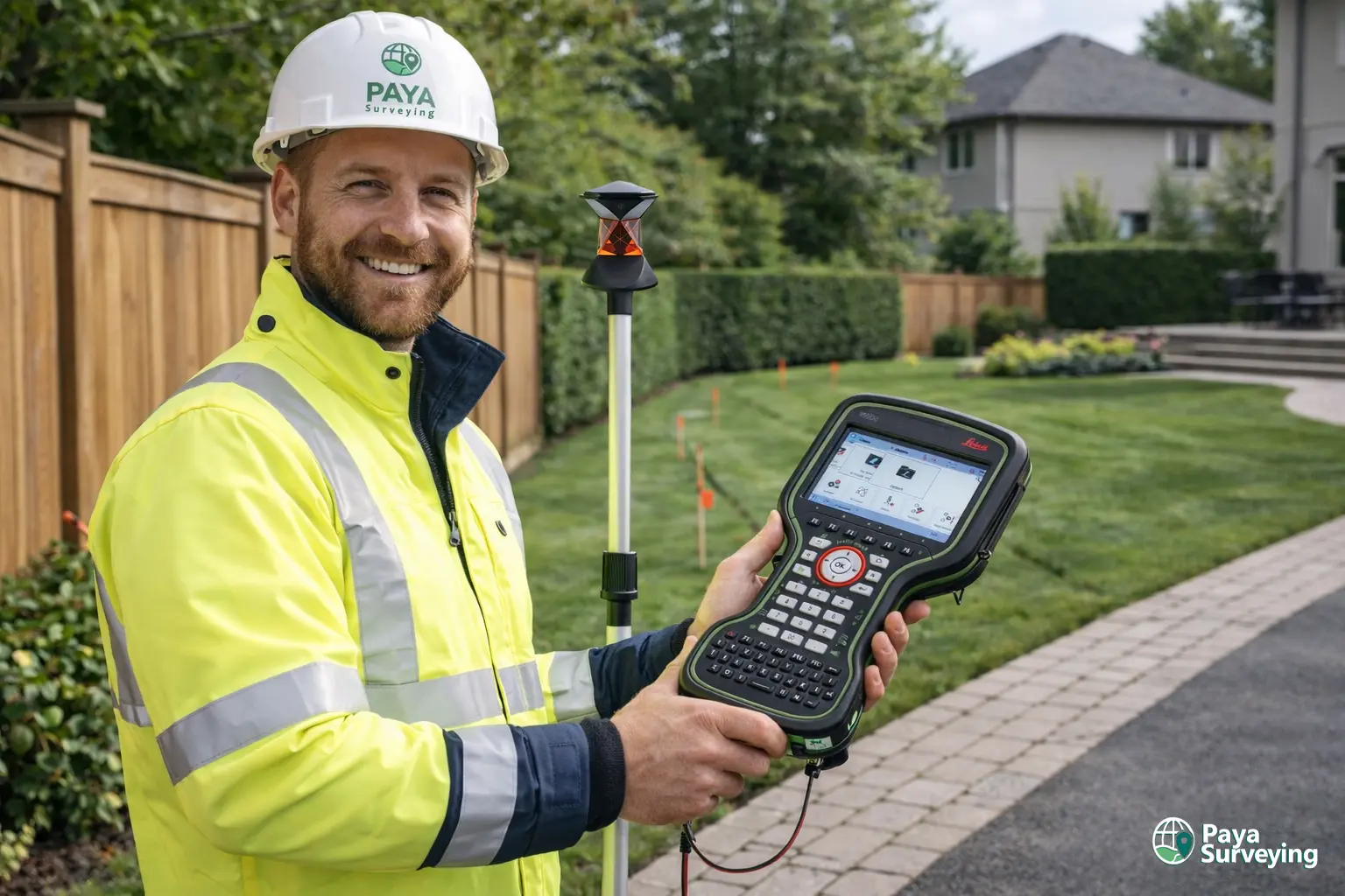
2) Base data (survey)
We confirm if you already have a usable survey. If not, we recommend a topographic survey so grades and features are referenced to measurable conditions.
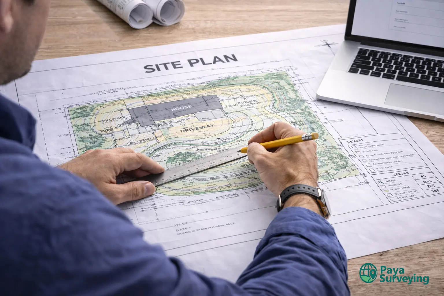
3) Drafting and coordination
We prepare the drawing set with readable layers, notes, and callouts. If your architect/engineer provides a proposed layout, we coordinate the grading intent around the design.
4) QA/QC
We check for completeness, consistency, and readability—because the fastest permit review is usually the one with fewer questions.
5) Delivery + support
You receive clean PDF deliverables (and CAD outputs if requested). We can help clarify the drawing set for your design team so your submission stays aligned.
6) Construction support (optional)
If you need staking or as-builts after approval, we can support with construction layout.
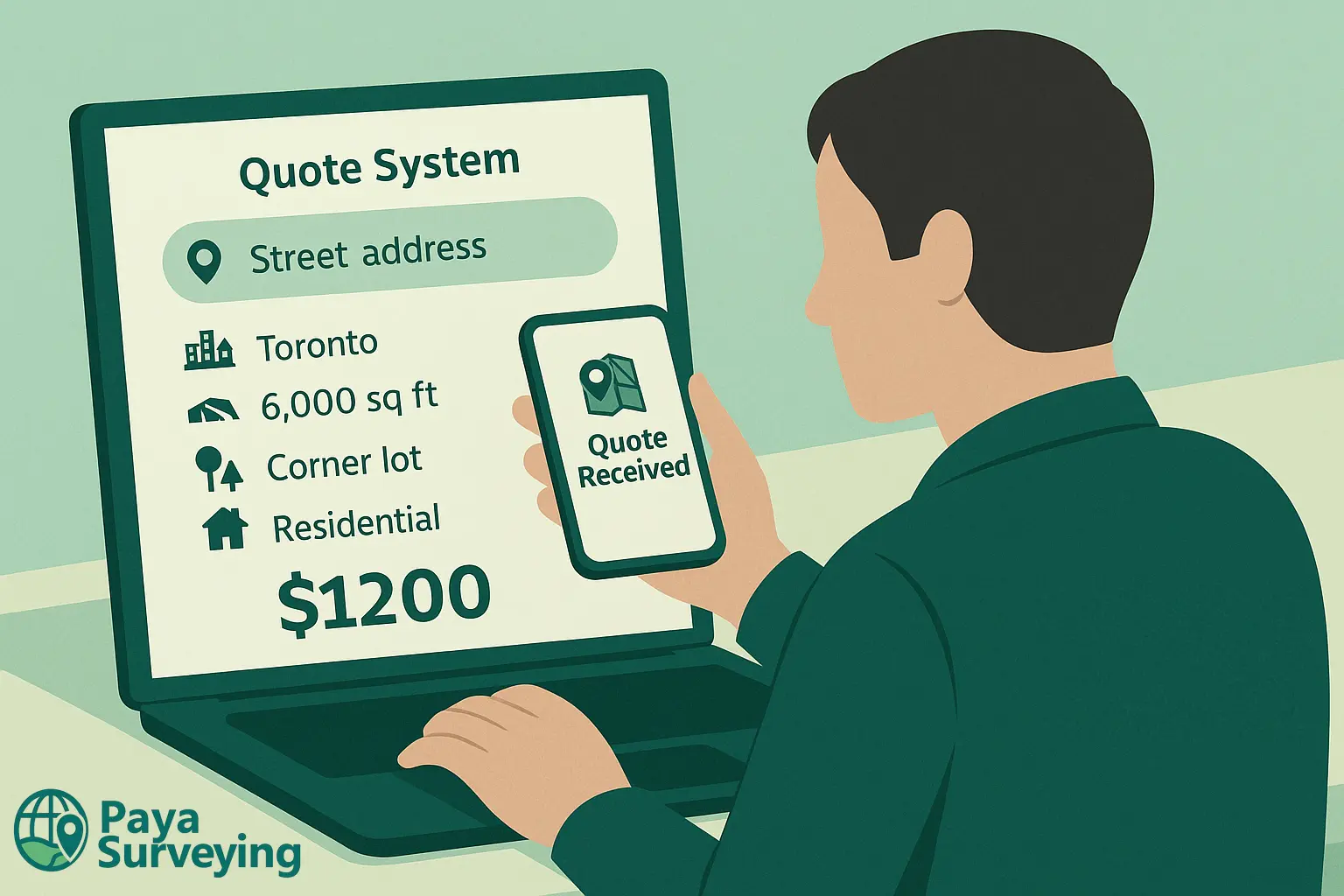
To reduce back-and-forth, we offer an instant quote for common residential survey needs. Enter your address to receive a fast estimate and view matched property details.
Thank You!
Our specialists will contact you shortly to discuss scope and next steps.
Toronto Public Resources We Reference
A grading plan is built on field measurements, but scope planning is also informed by official City guidance. Below are trusted links Toronto homeowners and design teams often use during permits and reviews.
Lot grading requirements for infill housing
City guidance related to lot grading submissions and responsibilities for infill projects.
Open lot grading requirements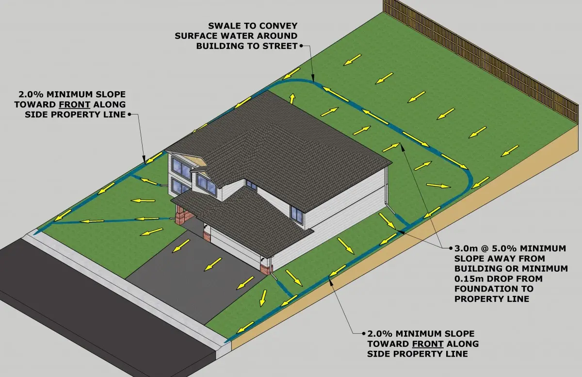
New house guide (lot grading plan)
City guide that mentions lot grading plans and general submission expectations for new houses.
Open new house guide
Building permit information
General building permit information and application resources for Toronto projects.
Open building permit page
Plan review process (what happens after you apply)
Overview of the permit plan review process and typical review steps.
Open plan review process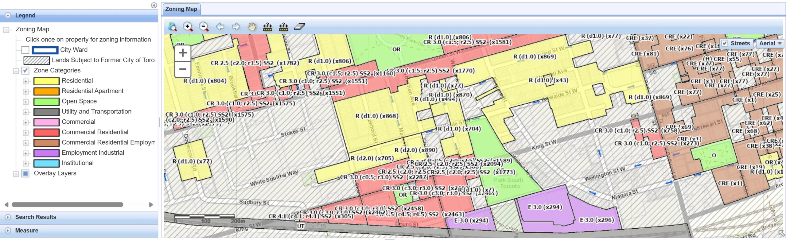
Zoning By-law & interactive zoning map
Setbacks and building placement depend on zoning rules, which connect directly to accurate site drawings.
Open Zoning By-law 569-2013 Open interactive zoning map
Survey plans and notes request (City records)
If you’re looking for historical survey records, this City service explains how to request available plans and notes.
Open survey records requestToronto & GTA Coverage
We support grading and site plan services across Toronto and surrounding municipalities in the GTA. Because requirements can vary by City, we align the drawing content to the applicable municipal review standards for your address.
Common GTA areas we support
Toronto • Mississauga • Brampton • Vaughan • Markham • Richmond Hill • Oakville • Pickering • Ajax • Whitby
Related Paya services (internal links)
Property Survey Toronto
Topographic Survey Toronto
Construction Layout Survey
LiDAR 3D Scanning
Drone UAV Surveying
Grading Site Plan Toronto FAQs
These are common questions homeowners and designers ask when preparing drawings for permits and drainage clarity.
Start Your Grading & Site Plan (Toronto & GTA)
Send your address and a short description of your project. We’ll recommend the right scope and help you move toward a clean, permit-ready drawing set—especially if you’re searching for grading site plan Toronto and want fewer revisions.