
Everything You Need to Know About
Whether you are buying a new home, subdividing land, or resolving boundary issues, property surveys are critical in Ontario. Among the most important documents are SRPR, SRPRR, and R-Plans. Understanding their role helps you avoid costly mistakes, secure financing, and comply with municipal regulations.
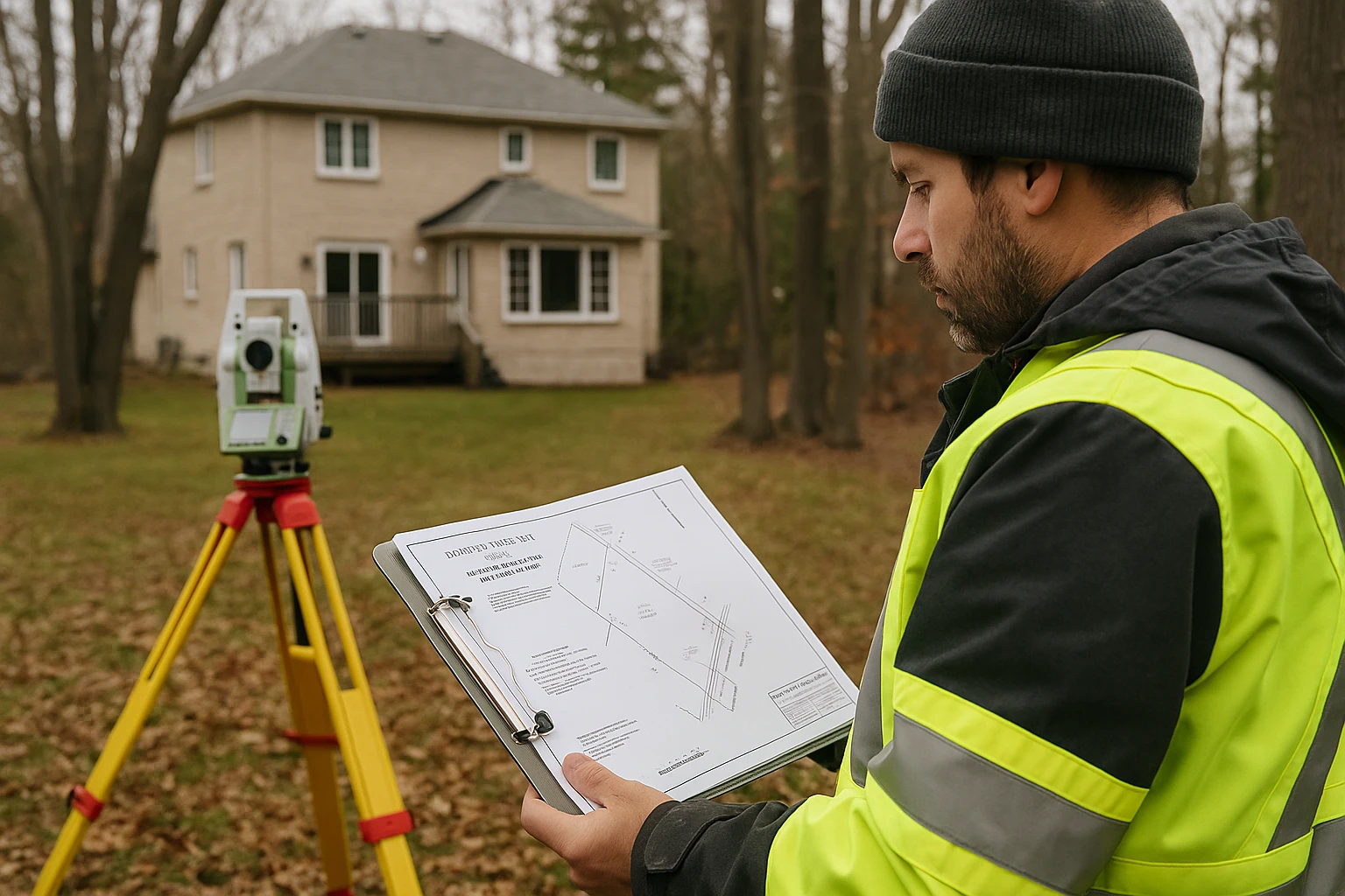
🔎 What is an SRPR?
A Surveyor’s Real Property Report (SRPR) is a legal survey prepared by a licensed Ontario Land Surveyor (OLS). It provides a snapshot of your property’s current condition and how the buildings, fences, and other structures relate to the legal boundaries.
- Exact property boundaries and dimensions
- Location of buildings, sheds, fences, and driveways
- Encroachments from neighbours or onto municipal land
- Notes on easements and rights-of-way
- Helps banks, buyers, and lawyers confirm no disputes exist

📑 What is an SRPRR?
An SRPRR (Surveyor’s Real Property Report with Reference Plan) includes everything in an SRPR but also ties the survey to a registered R-Plan at the Ontario Land Registry Office. This is especially important for:
- Land severances and subdivisions
- Municipal approvals for building permits
- Resolving boundary disputes in court

📐 What is an R-Plan?
An R-Plan (Reference Plan) is a survey registered with the Ontario Land Registry. Unlike an SRPR, which is for private use, an R-Plan becomes part of the permanent public record. It legally describes parcels and is commonly used for:
- Severing a property into new lots
- Creating easements for utilities, driveways, or access roads
- Road widenings and municipal infrastructure projects
- Providing exact bearings and distances for deeds

⚖️ SRPR vs R-Plan — Key Differences
Many people confuse SRPRs with R-Plans, but they serve different purposes. Here is a detailed comparison:
| Feature | SRPR | R-Plan |
|---|---|---|
| Purpose | Buying/selling, financing, permits | Land severance, easements, subdivisions |
| Registration | Private report, not registered | Registered at Land Registry |
| Users | Owners, buyers, lenders, lawyers | Municipalities, developers, surveyors |
| Validity | Valid only at time of survey | Permanent public record |
| Cost | Lower, depends on property size | Higher, requires registry fees |
| Detail | Shows existing improvements | Focuses on land parcels |
📋 SRPR – Surveyor’s Real Property Report
- Buying or selling a property
- Mortgage or refinancing
- Confirming fences & property lines
- Getting a building permit
📐 R-Plan – Reference Plan
- Severing a property into new lots
- Creating easements (utilities, driveways)
- Road widenings & municipal projects
- Registering boundaries with Land Registry
❓ Frequently Asked Questions
Need an SRPR, SRPRR, or R-Plan?
Accurate surveys, faster approvals, and smoother property deals — trusted by homeowners, buyers, and developers across Ontario.
Get a Free Quote