
3D Laser Scanning & LiDAR Mapping in Toronto & GTA
We deliver high-precision LiDAR & 3D scanning services across Toronto & GTA — combining Drone LiDAR, Terrestrial Laser Scanners (TLS) and SLAM to produce clean, control-tied point clouds and CAD/BIM-ready models.
About LiDAR & 3D Scanning
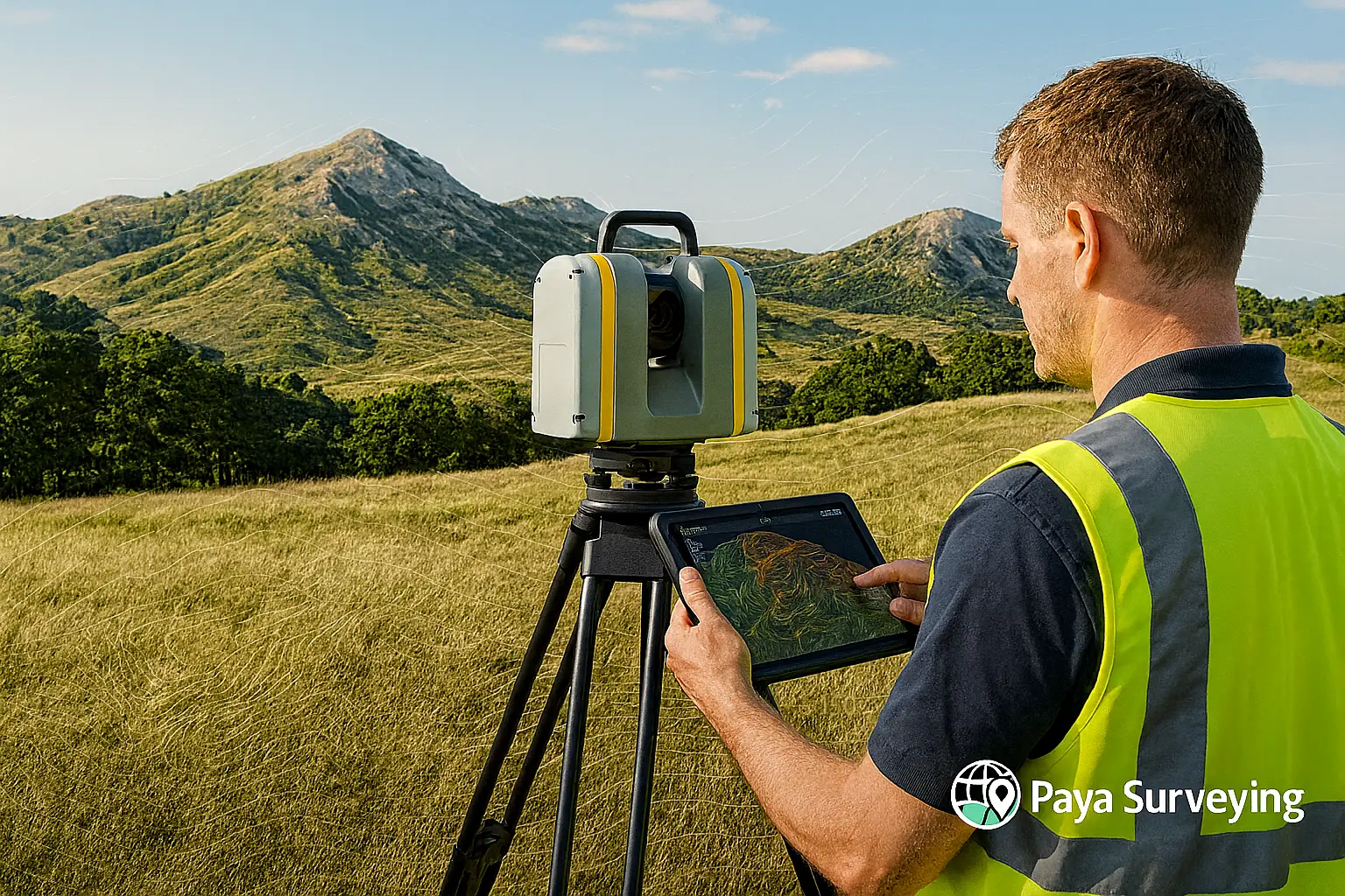
LiDAR (Light Detection and Ranging) uses rapid laser pulses to measure distances and form detailed 3D point clouds. Across Toronto and the Greater Toronto Area, this technology captures site conditions faster and more accurately than traditional methods, reducing safety risks and field time.
By integrating laser scanning into engineering and architectural workflows, our clients gain precise geometry for modeling, design validation, and progress tracking. From complex industrial plants to residential developments, LiDAR provides reliable data that improves decision-making and project efficiency.
Technology & Accuracy
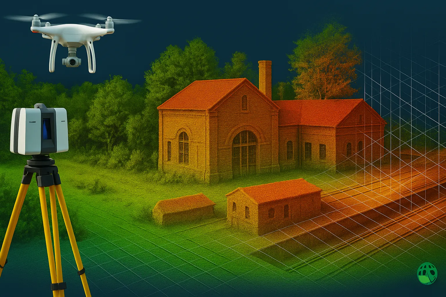
Our scanning systems include aerial Drone LiDAR for large-scale mapping, Terrestrial Laser Scanning (TLS) for high-detail work, and SLAM-based mobile scanners for interiors. Each dataset is geo-referenced using survey-grade control networks and processed through rigorous QA to maintain accuracy within 1–2 cm.
All deliverables are compatible with Autodesk Civil 3D, Revit, and CAD environments — enabling seamless integration into your design process.
Applications
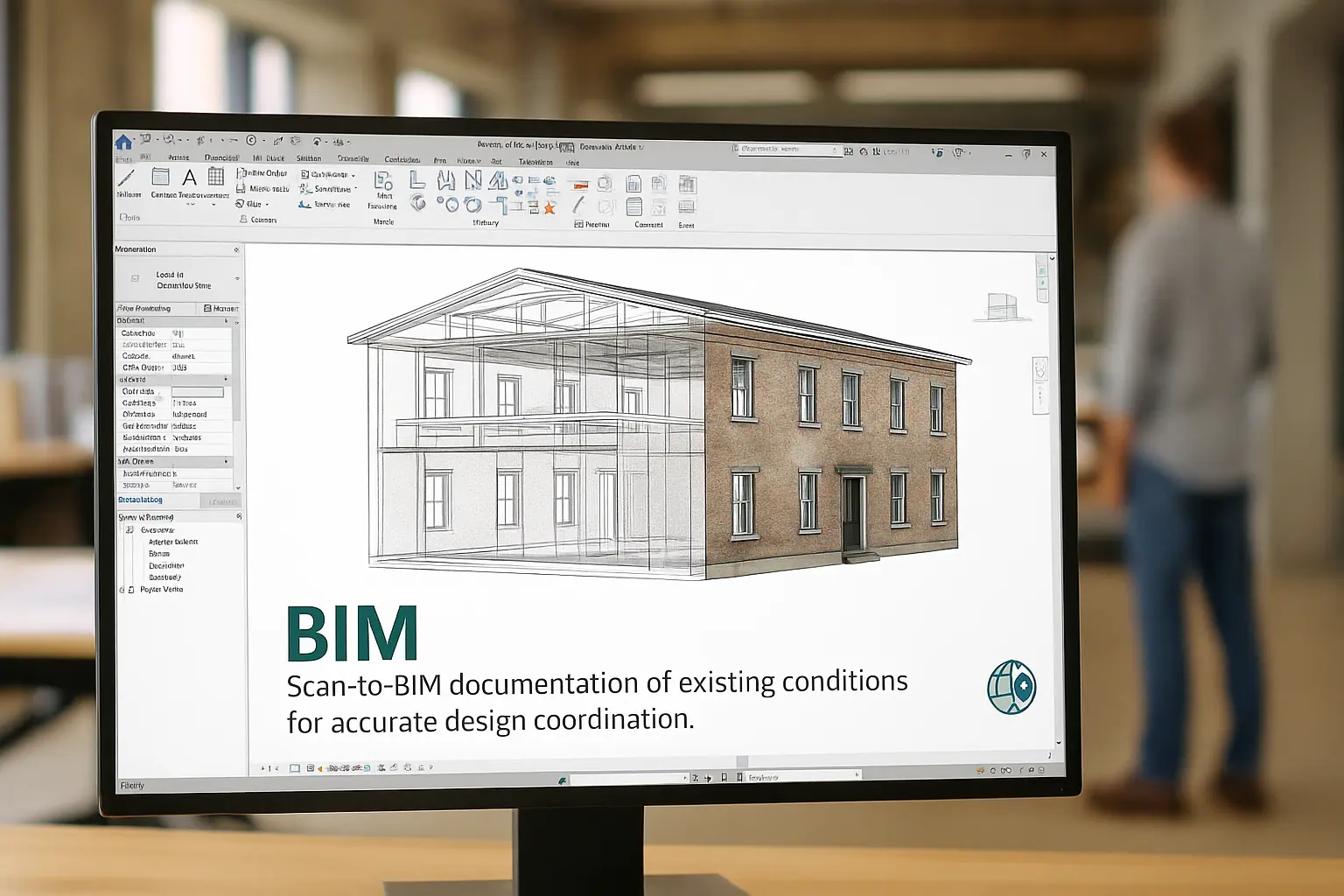
🏢 BIM
Scan-to-BIM documentation of existing conditions for precise coordination and facility modeling.
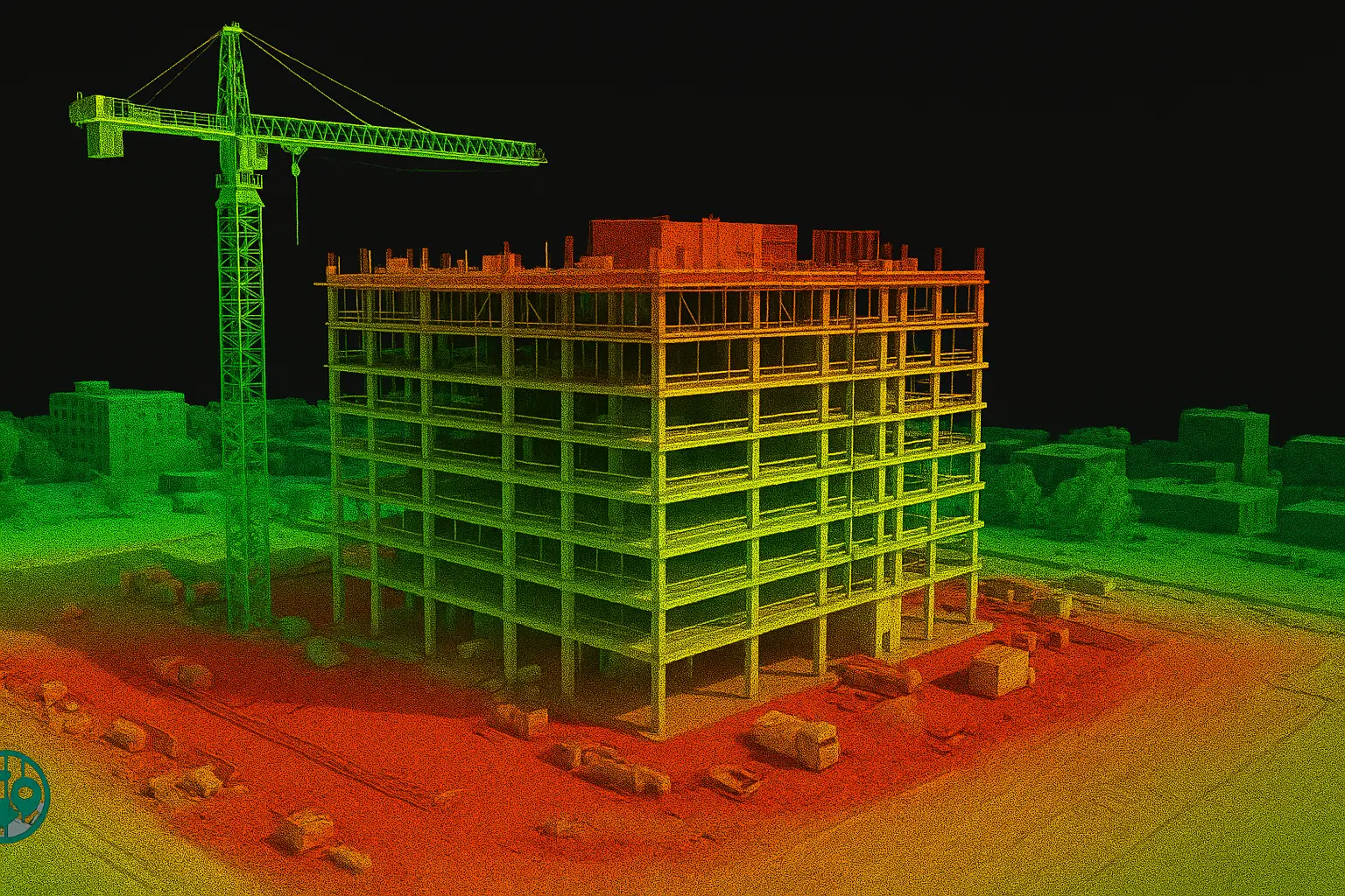
🏗️ Construction
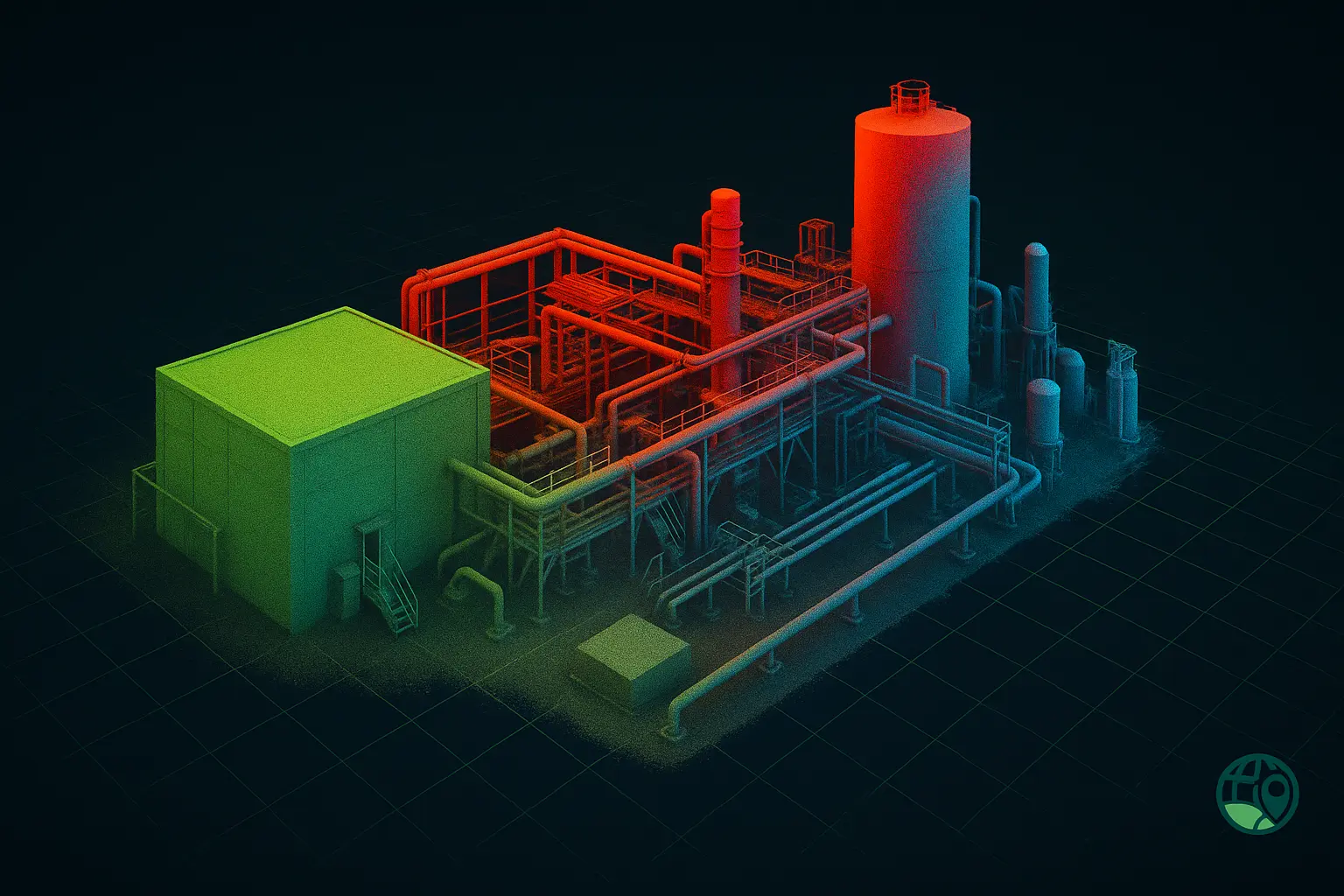
As-built verification, progress monitoring, and quality checks across complex sites.
📐 Structural
Deflection, clearance, and deformation studies for bridges, tunnels, and industrial facilities.
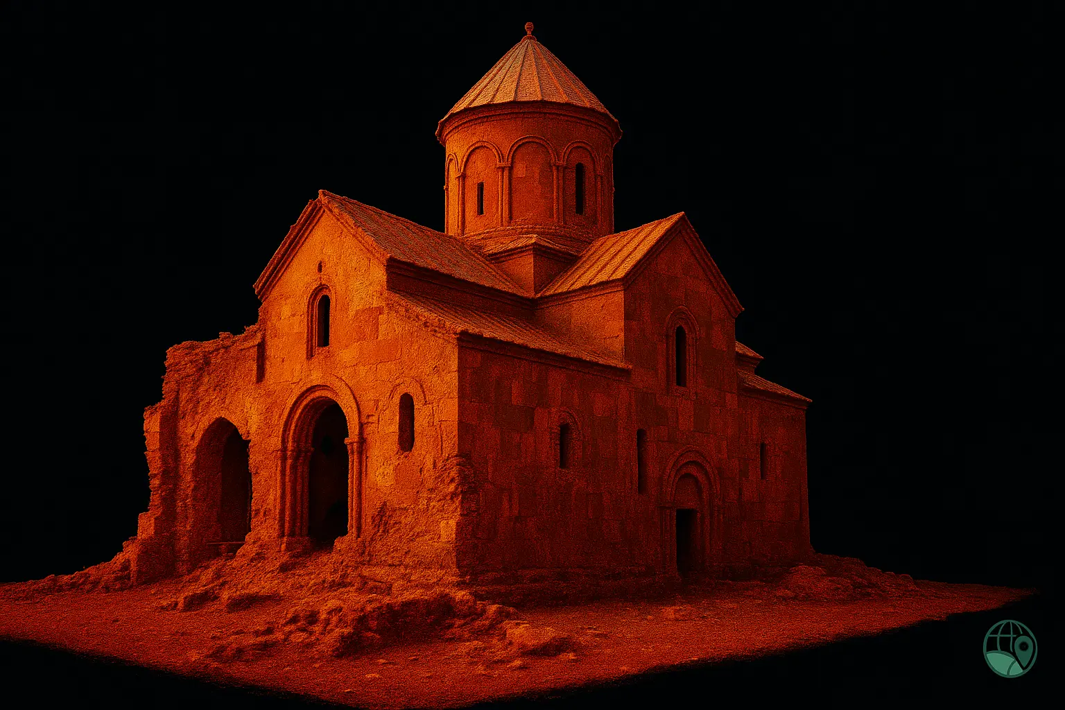
🏛️ Heritage
Non-invasive scanning for heritage documentation, conservation, and digital archiving.
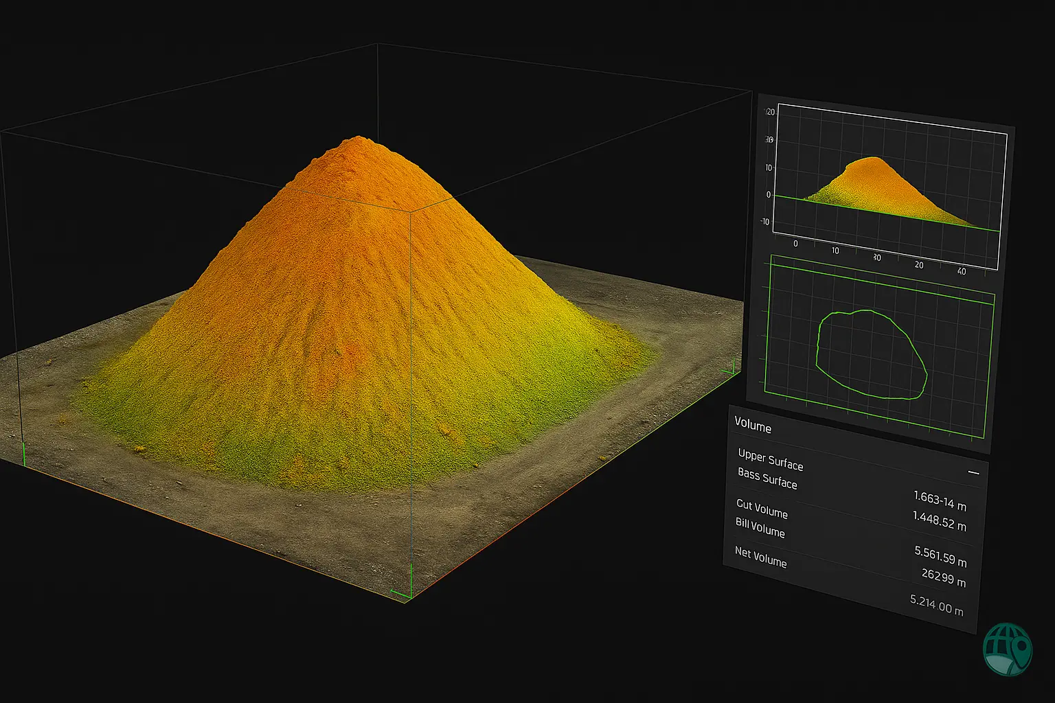
⛏️ Volume
Cut/fill analysis, stockpile volume reporting, and site progress comparison.
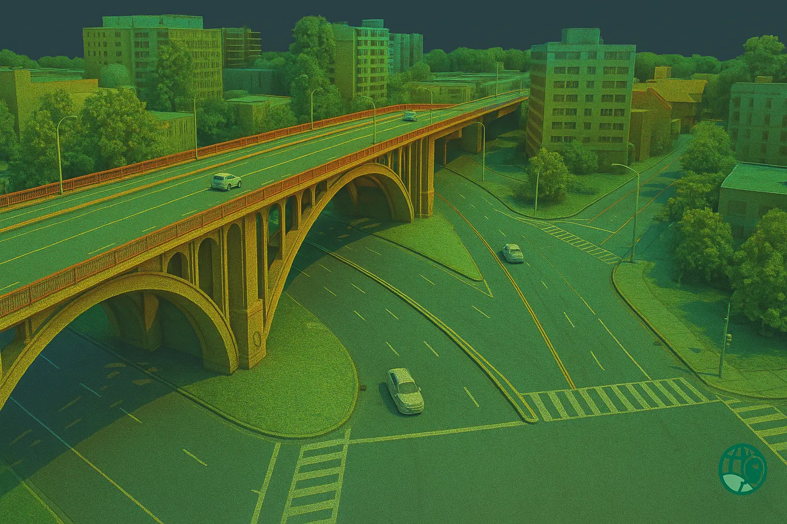
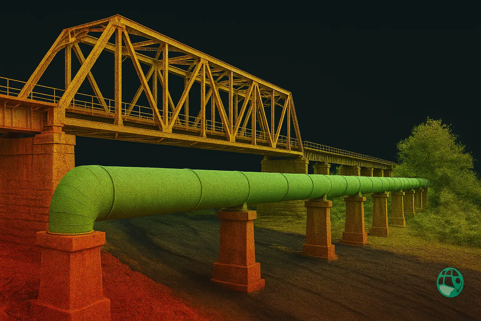
🏙️ Urban Infrastructure
Mapping bridges, roads, and corridors using drone and terrestrial LiDAR for design and inspection.
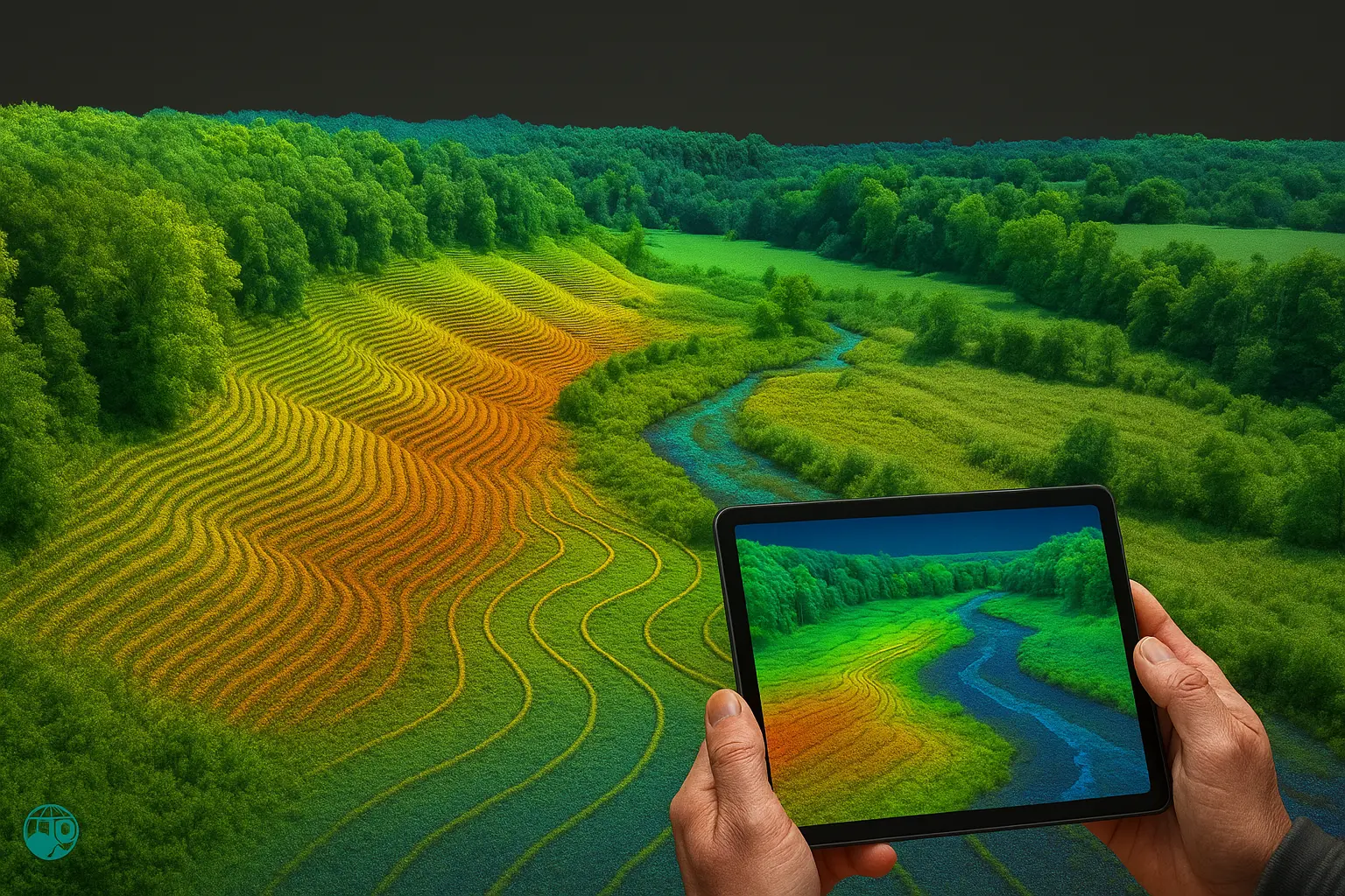
🌿 Environmental Monitoring
Topography, vegetation, and floodplain mapping with high-resolution LiDAR data.
🏠 Facility Management
3D scanning for maintenance, renovation, and creation of digital twin environments.
Deliverables
Point Clouds
Classified LAS/LAZ or E57 data tied to control points.
Meshes & Surfaces
OBJ/PLY models, DSM/DTM surfaces, and contour exports.
CAD/BIM
DWG/DGN, IFC, or Revit-ready models aligned to your project standards.
Reports
QA/QC documentation, control summaries, and coordinate transformations.
All LiDAR and 3D scanning deliverables are processed using industry-leading software such as Leica Cyclone, Trimble RealWorks, and Autodesk ReCap. Our workflow ensures accurate, structured datasets ready for integration into design, BIM, and GIS environments.
Workflow
Planning
Defining project scope, coordinate system, and site access requirements.
Data Capture
Scanning using Drone, TLS, or SLAM with on-site quality checks.
Processing
Registration, classification, and cleaning of point clouds.
QA & Delivery
Verification, reporting, and export to CAD/BIM formats.
Why Choose Paya Surveying
Accuracy
Control-tied datasets with consistent QA ensure centimeter-level precision.
Fast Turnaround
Optimized capture and processing workflows minimize project downtime.
Licensed Collaboration
Partner Ontario Land Surveyor (OLS) sign-off available for legal mapping requirements. Learn more about our Topographic Surveying and Drone Mapping services.
Frequently Asked Questions
How accurate is LiDAR / 3D scanning?
Terrestrial scanners deliver millimetre-level precision; drone LiDAR achieves survey-grade accuracy when tied to reliable control.
Can you combine drone LiDAR with terrestrial scans?
Yes — we integrate aerial LiDAR, TLS, and SLAM for complete coverage, including interiors and elevations. All operations comply with Transport Canada drone regulations.
What deliverables will I receive?
Point clouds (LAS/E57), meshes (OBJ/PLY), CAD (DWG/DGN), and quality assurance reports, all geo-referenced and ready for design use.
Ready to Elevate Your Project?
Request a LiDAR or 3D scanning survey — accurate, fast, and engineered for professional results.
Request a Free Quote